
DailyPost 1822
GEOSPATIAL TECHNOLOGY FOR HOMELAND SECURITY
Homeland Security as an independent practice is the integration of all agencies and departments fighting for the security of the homeland. Department of Homeland Security of the US govt, created as an aftermath of 9/11 was the biggest administrative exercise in the history of mankind. Need to know to shared information made the dramatic change. The integration of databases was another paradigm shift in the way we use data, on the fly, for a variety of purposes, while maintaining its confidentiality and dynamic and real time creation. Security and as a consequence of it, technology took the world center stage, never to change.
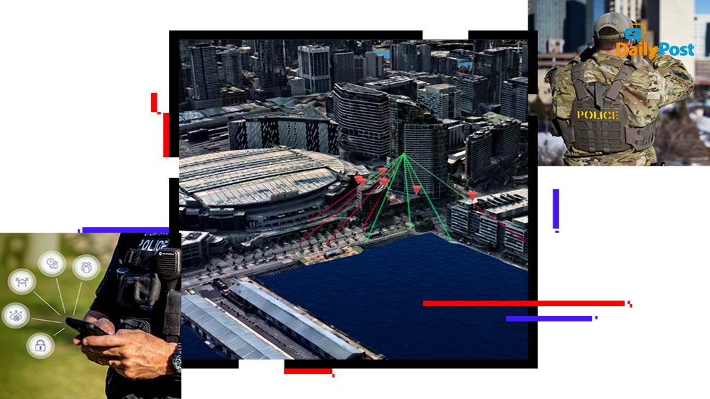
Data and technology need a temporal and spatial reference point. We live and operate in a geography and that is not going to change. Before and after imagery, we are all so thrilled to see and decide the quantum of change based on it. Herein, lies the enormous need and utility of geospatial technology. The success of the Department of Homeland Security depends to a considerable degree on the primacy provided to create, improve and integrate systems of geospatial technology and make it an integral part of its regular playbook. It gave enormous dividends in the battlefields, as they remained embroiled for the last two decades in Iraq, Afghanistan and other tricky war zones.
Geospatial technology is the science of where, where everything has a time and space. In India we are caught in a time warp whether to improve our internal security performance by investing in this technology for our future or keep being embroiled in our day and day policing activities. Otherwise, you move and operate blindfolded, we need to have the imagery, GIS, remote sensing support as and when required. These resources have to be made available as a matter of routine. One of the young naval officers faced issues of imagery and targeting in Operation Desert Storm, also known as Gulf War, made it his life’s mission to keep improving it.
He went ahead to become the head of National Geospatial Intelligence Agency. Wrong targets should become an act of the past. Cross referencing should be available on the fly. Think of damage done because of wrong locations being targeted. In the raid and killing of Osama Bin Laden, geospatial technology came in handy. Think of all the movements of 9/11 perpetrators through public spaces and public utilities being mapped and intelligence created out of it. From Satellite imagery to drone footage, with the processing capabilities available today, we can add in everything we do. Imagine a life without Google Maps and you will understand what this technology is all about. We are in the Age of GEOINT, it is an age of spatial repository, integration, analytics and instant execution.
THE THIRD EYE GRADUATES TO AN ALL ENCOMPASSING VIEW WITH INTELLIGENCE.
Sanjay Sahay